Flight 19: The Lost Avengers and the Separate Rescue Disaster
Five Navy TBM Avengers disappeared with 14 men after a navigation crisis. A separate PBM search aircraft carrying 13 rescuers was probably destroyed by an explosion.
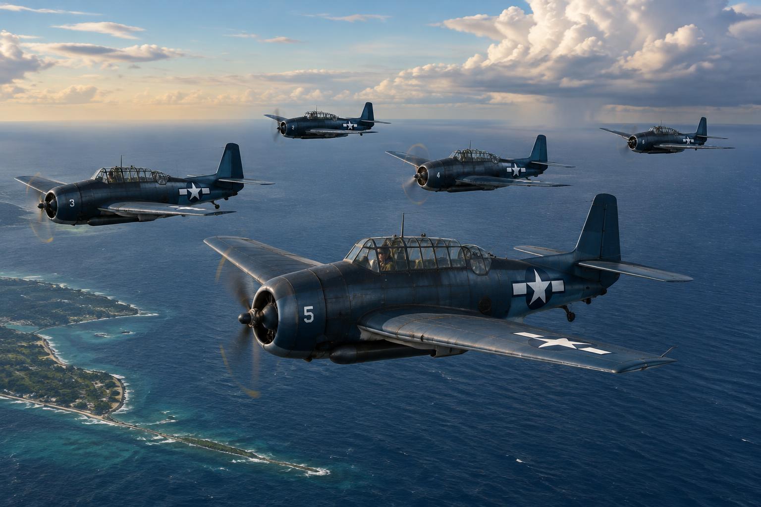
Illustrative reconstruction; not an archival photograph.
Five aircraft, fourteen men
Flight 19 was not one aircraft. It was a formation of five TBM Avenger torpedo bombers that departed Naval Air Station Fort Lauderdale on December 5, 1945, for an overwater training exercise. Four trainee pilots flew with the instructor leading the formation, and aircrew brought the total aboard the five aircraft to fourteen. All were lost. A later search aircraft carried another thirteen men; its loss was a separate event.
The Navy’s investigation identifies the individual aircraft and the assigned route, providing an unusually concrete starting point for a disappearance later wrapped in Bermuda Triangle folklore. This distinction in numbers matters. Fourteen were not all inexperienced student pilots, and thirteen additional rescuers were not aboard a sixth Avenger accompanying the exercise. Preserving the two groups and their different circumstances is essential to understanding both the operational crisis and the disaster that followed.
2:10 p.m.: a planned training circuit
The five aircraft took off at approximately 2:10 p.m. The assignment, Navigation Problem No. 1, combined practice bombing with a three-leg navigation exercise. It began eastward from Florida toward Hen and Chickens Shoals, continued farther east, turned generally north and then southwest toward the starting area. The investigation records bearings and distances, not a mission into uncharted territory.
The exercise depended on dead reckoning, compass headings, timing, visual recognition and radio assistance rather than satellite navigation. The route crossed water and islands whose appearance could be ambiguous when a pilot misunderstood his position. None of that made the flight inherently inexplicable. The institutional history published by the Naval History and Heritage Command places the disappearance within the hazards of naval aviation and the surviving investigation. The route’s routine status explains why the aircraft were there; it does not mean that a serious navigational error over open water would have been easy to reverse.
Taylor’s experience and a dangerous misidentification
Lieutenant Charles Carroll Taylor was an experienced naval aviator with a Pacific combat tour and roughly 2,500 flying hours. Experience makes the loss more poignant, but it does not rule out disorientation. The central reconstruction is that he mistook Bahamian islands for the Florida Keys, placing the formation mentally on the wrong side of the Florida peninsula.
That mistaken premise would invert the meaning of a corrective heading. If an aviator believed he was over the Keys, a northeasterly course might seem to lead toward Florida; from the Bahamas, it could take him farther into the Atlantic. Navy historical analysis treats Taylor’s position estimate as central to the developing crisis. It remains a reconstruction from radio evidence and investigation, not a recovered cockpit recording showing every decision. The difference is important when assigning individual responsibility to a man who could not testify afterward.
Radio contact reveals a navigation emergency
During the afternoon, other aviators and shore stations heard exchanges indicating confusion about position and headings. Taylor reported compass trouble. Assistance was attempted, and voices within the formation favored flying west, which would have been the basic direction toward the Florida mainland if they were east of it. The surviving radio evidence describes a prolonged emergency, not five aircraft vanishing instantaneously without communication.
It does not establish that every compass in all five aircraft failed simultaneously. A report of trouble in the leader’s instruments is frequently enlarged in popular retellings into a regional breakdown of navigation itself. That enlargement is unsupported. There were also practical problems with radio reception, frequency changes and maintaining contact with an increasingly distant formation. The record supports uncertainty, disagreement and attempts at recovery. It cannot reliably supply every speaker’s identity or every exact aircraft position at each moment. Dramatic dialogue added by later writers should not be substituted for documented transmissions.
Fuel, darkness and the narrowing options
As the afternoon continued, the formation’s options became worse. Even a correct heading could not restore fuel already consumed, and offshore weather, darkness and deteriorating sea conditions would make ditching and survival increasingly dangerous. A formation could remain airborne for hours while its crews’ chances of returning safely steadily declined.
The U.S. Naval Institute’s historical account reconstructs the exercise, radio exchanges and subsequent loss from the established record. It presents the disappearance as a navigation and aviation disaster, not proof of an unknown physical force. Fuel exhaustion followed by ditching is the leading explanation for the Avengers’ final fate. It should still be described as probable rather than observed. No confirmed wreck-site evidence establishes the exact order in which the aircraft came down, whether they remained together to the end or what any individual crew experienced in its final minutes.
The inquiry and the meaning of unknown
A Navy board investigated the disappearance through testimony, aircraft information, radio reports and search evidence. Its findings are more informative than the simplified official verdict often quoted in mystery collections. The inquiry explored Taylor’s mistaken geographical assessment and the likelihood that the aircraft exhausted their fuel at sea.
The conclusions concerning responsibility were subsequently revised, and the final cause was recorded as unknown. That administrative caution did not establish that conventional explanations had failed or that an exotic force had been detected. It recognized limits in proving what happened without survivors or recovered aircraft. The published board material and the Navy’s later historical discussion should be read together: one preserves the contemporary process, while the other explains its evidential and institutional context. A verdict of unknown is a statement about what can be concluded to an official standard. It is not an affirmative finding that the loss defied navigation, weather, machinery or human error.
The PBM Mariner: thirteen more lives
A Martin PBM Mariner dispatched in the search disappeared with thirteen crew members after taking off from Naval Air Station Banana River that evening. This was a different aircraft type, with a different mission and a different probable mechanism of loss. Combining it with the Avengers as six aircraft swallowed by one phenomenon obscures the strongest evidence about the rescuers.
A nearby merchant vessel reported an explosion and subsequently found a burning patch of fuel on the water in the relevant area and period. The investigation treated an airborne explosion as the likely explanation for the PBM’s destruction. The Navy’s historical treatment also discusses the Mariner’s known vulnerability to fuel-vapor hazards. This does not establish the precise ignition source. It supplies affirmative evidence of a probable accident, however, rather than merely the absence of a returning search plane. The rescuers’ deaths should not be reduced to an unexplained afterthought.
Searching an ocean without a final position
Search forces faced an enormous area, uncertain last positions, moving water and poor conditions. A broad radio-derived location is not a fixed wreck coordinate. Aircraft can travel far after a transmission, and a ditching location can differ significantly from the point investigators initially prioritize. Floating wreckage can disperse, sink or be missed between search passes.
The failure to recover confirmed wrecks does not prove that no wrecks exist, nor does it validate every later announcement of an Avenger discovery. The type operated widely during wartime training, so finding an aircraft of the right general design is not sufficient identification. Serial numbers, location, configuration and a defensible chain of archaeological evidence are needed. The absence of a securely identified Flight 19 wreck leaves the final sequence unresolved. It does not erase the earlier radio record or the evidence for a progressively worsening navigational emergency before contact was lost.
How the Bermuda Triangle absorbed the disaster
Flight 19 became one of the foundational examples in later Bermuda Triangle literature. The appeal is obvious: multiple aircraft, military personnel, radio confusion, an ocean search and another aircraft lost while trying to help. Retellings could compress hours of distress into a sudden disappearance and turn reported compass trouble into a universal instrument failure.
NOAA describes the Bermuda Triangle as a region of alleged mysterious losses and notes that the Navy and Coast Guard do not support supernatural explanations for disasters there. It emphasizes environmental conditions and human fallibility, and explains that the Triangle has no officially recognized boundaries. That general assessment does not solve every detail of Flight 19. It does prevent a circular argument in which the flight proves the Triangle’s power and the Triangle then supplies the explanation for the flight. A popular geographical label is not an independently demonstrated cause of an accident.
The planned bearings, not a mysterious route
The board’s second finding specifies the exercise in unusually concrete terms. From the Fort Lauderdale departure point the formation was to fly a true course of 091 degrees for 56 miles to Hen and Chickens Shoals, conduct low-level bombing, and continue another 67 miles on the same bearing. The next leg was 346 degrees for 73 miles, followed by 241 degrees for 120 miles and a return to the station. These are the board’s stated distances and true bearings, not a reconstruction from a later Triangle map.
This specificity matters because it gives investigators a planned geometry against which to compare the radio crisis. A plan is not proof of actual position: a missed turn, wind drift or mistaken landmark could move a formation away from it. Nevertheless, the route was neither undefined nor selected as a test of an alleged anomalous region. The historical problem is how the flight diverged from a known training assignment, not why the Navy sent men into a location already understood to possess supernatural properties.
The aircraft can be distinguished individually
The inquiry identified Taylor’s aircraft as FT-28, Bureau Number 23307. The other aircraft were FT-36, Bureau Number 46094; FT-117, Bureau Number 73209; FT-81, Bureau Number 46325; and FT-3, Bureau Number 45714. The findings also distinguish Avenger variants rather than describing five mechanically identical machines. Those numbers are prosaic, but they provide something legends cannot: a means of testing whether a recovered wreck actually belonged to the missing formation.
A formation name is not enough for archaeological identification. Another Avenger could share the same silhouette and general period without sharing this mission. A photograph of an engine or wing must therefore be connected to a defensible identity, not merely a plausible type. The records also prevent the loss from becoming an abstract collection of interchangeable aircraft. Each had a separate acceptance for flight, a pilot and assigned personnel. The disappearance joined their histories operationally; it did not erase the individuality of the machines or the men aboard them.
Advanced students were qualified aviators
The board named Edward Joseph Powers Jr., George William Stivers, Forrest James Gerber and Joseph Tipton Bossi as the other pilots. It explicitly found that all five pilots were qualified naval aviators. Four were undergoing advanced training in the aircraft type, and the inquiry recorded completion of the required ground syllabus. Their student status therefore meant participation in a further stage of military instruction, not that they were making their first flights or lacked basic qualification.
Taylor’s record was also more substantial than a simple instructor label suggests. The findings give 2,509.3 flying hours, service as a scout pilot based at Key West and a recent carrier torpedo-plane combat tour on USS Hancock. Those details make a geographical misidentification possible without making it trivial. Familiarity with one coastline could even become relevant to how a mistaken recognition took hold, but that psychological mechanism remains an interpretation. The service record documents experience; it does not reveal the precise mental process behind a decision made over the ocean.
Around 4 p.m.: help begins locally
The inquiry placed an attempted assisting contact at approximately 4 p.m., when Lieutenant Robert F. Fox was flying FT-74 near Fort Lauderdale. It recorded fading radio reception during his contact with FT-28. Fort Lauderdale learned by 4:11 that Taylor was uncertain of his position, while the air-sea rescue organization at Port Everglades was aware of the difficulty at approximately 4 p.m. These findings show that the emergency entered a local assistance network well before the evening search aircraft disappeared.
The timing also narrows what disappearance means in this case. The flight did not move directly from a normal departure to complete absence. People outside the formation knew there was trouble, attempted contact and passed information through organizations with different responsibilities. The words used in a finding about a supposed Keys position must be read against the investigation’s broader uncertainty: a location believed or reported during an emergency is not necessarily an independently verified fix. The record’s value lies partly in showing how uncertain information circulated, not merely in supplying points for a map.
4:30 to 4:47: the wider network is alerted
According to the board, the Joint Operation Center of the Gulf Sea Frontier air-sea rescue organization knew of FT-28’s difficulty at approximately 4:30 p.m. At 4:47, the Gulf and Eastern Sea Frontier high-frequency direction-finding networks were alerted to obtain bearings on the flight leader’s transmissions. The specified frequency was 4,805 kilocycles. This was a technical effort to derive position from radio signals, not a reliance solely on Taylor’s recognition of islands.
Direction finding nevertheless depended on receiving suitable transmissions and combining observations. Alerting a network did not instantly create a precise location, still less place a rescue aircraft alongside the formation. These institutional timestamps help explain why an emergency can be actively handled while its central uncertainty persists. There was no single observer who simultaneously possessed every radio report, every proposed heading and a verified view of the aircraft. Later narratives can assemble those fragments on one page in a way unavailable to participants making decisions as the messages arrived.
5:50: a large area, not a point
The board found that at approximately 6 p.m. an evaluated radio fix had been obtained for the flight at 5:50. It placed FT-28 within a hundred-mile radius of 29 degrees 15 minutes north, 79 degrees west. The radius is as important as the coordinates. A point printed on a chart can look authoritative, but this finding describes a broad area of uncertainty rather than an aircraft located exactly at its center.
The fix also had a time attached. Even a correct area estimate for 5:50 would not establish a later ditching position, since the formation could continue flying afterward. It cannot settle which heading was flown throughout the remaining period or whether all five aircraft occupied exactly the same area at the end. The board’s formulation is therefore evidence for a geographic reconstruction with limits. Removing those limits would convert a useful technical finding into an unjustified wreck coordinate and invite false confidence about where the search ought to have succeeded.
6:10 to 6:36: position information moves
The inquiry recorded that the evaluated position was telephoned to the Fort Lauderdale tower at about 6:10 p.m. It was distributed on the relevant direction-finding and air-sea rescue teletype networks at approximately 6:36. Between those times, at 6:20, an air-sea rescue aircraft departed the Coast Guard station at Dinner Key to attempt communication on the flight’s frequency. The board found that this effort did not succeed in contacting Flight 19.
These entries distinguish several events often collapsed into one: obtaining a fix, communicating it, dispatching an aircraft and actually establishing contact. Success at the first step did not guarantee success at the last. They also show that the PBM later lost was not the only attempt to help. An unsuccessful radio-assistance mission and a destroyed search aircraft belong to different evidential categories. Restoring the Dinner Key effort makes the rescue history more complete without inventing a conversation that its crew never managed to have with the missing formation.
A functioning aid is not proof it was received
One concise board finding states that the YG homing device at Fort Lauderdale was operating properly at approximately 4:25 p.m. That observation matters because it limits explanations based on a universal collapse of the station’s equipment. It does not prove that the lost crews successfully used the aid, could receive it under their circumstances, or understood a correct course home from it. An equipment check at a station and effective navigation in a distressed aircraft are different propositions.
The distinction is also a safeguard against hindsight. With the outcome known, every available assistance measure can appear to have been an obvious solution. In practice, reception, position assumptions and formation decisions could prevent a technically sound facility from resolving a crisis. The documents support examination of such ordinary failure chains. They do not justify a claim that every navigation device failed, nor do they establish that one functioning device made a safe recovery inevitable. The investigation’s concrete findings are strongest when allowed to retain their original scope.
7:27 and 7:30: the Mariner’s brief record
The board identifies the missing search aircraft as PBM-5 Bureau Number 59225, squadron training number 49. It departed Banana River at approximately 7:27 p.m., and the station received an outgoing radio report at about 7:30. The inquiry recorded no subsequent communication from it. Its assigned search was to proceed to the Florida east coast at 29 degrees north and begin an expanding-square search. This is an identifiable rescue operation, not an aircraft sent after a rumor without a plan.
Lieutenant junior grade Walter G. Jeffrey was the patrol-plane commander. The findings give him 1,917.8 flying hours and identify additional pilots, a radar officer and enlisted crewmen. Those details restore professional roles to the thirteen rescuers. Their aircraft’s short communications history differs sharply from the Avengers’ prolonged navigation emergency. It is therefore misleading to describe the two losses as exhibiting an identical pattern. They were linked by the rescue mission, but the evidence points toward different final mechanisms and different degrees of knowledge about those mechanisms.
Search findings and the limits of recovery
The board recorded extensive land and sea searches from December 6 through December 10 without discovery of Flight 19 wreckage or survivors. That is a dated statement about the contemporary operation. It should not be enlarged into a claim that every possible area has since been exhaustively examined or that modern equipment must be able to locate the aircraft if conventional loss occurred. The search was constrained by what rescuers could infer about a moving flight with an uncertain final position.
Nor does the negative search result make all proposed explanations equally strong. The preceding radio evidence still supports a navigation crisis; the lack of a wreck prevents confirmation of the final sequence. Those propositions can coexist. A discovery would be most valuable if it supplied identity, location and evidence of damage or ditching, rather than merely adding another dramatic underwater image. Until then, the final physical evidence remains missing, but the documentary record is substantial enough to exclude the popular picture of an entirely unheralded disappearance.
What the surviving documents reveal
The board convened at Jacksonville on December 7, 1945. Its findings and related correspondence are now available through the HyperWar transcription cited here. That accessibility should not be mistaken for a newly announced declassification or a hidden final revelation. A modern reader is encountering an investigation whose qualifications and uncertainties have often been flattened by retelling. Reading its numbered findings restores administrative detail, individual identities and the sequence in which information became available.
The result is not a complete solution reconstructed minute by minute inside five cockpits. It is a better boundary around uncertainty. We can specify planned courses, several assistance times, a broad direction-finding area and the Mariner’s departure without claiming to know a final ditching coordinate. That is also the strongest answer to the Triangle interpretation: the absence of a last chapter does not erase the documented chapters before it. The men were lost in two connected aviation operations, and their histories deserve more exact treatment than a shared label of inexplicability.
An unresolved location, not supernatural evidence
The most defensible reconstruction separates what is documented from what is probable. Five TBM Avengers left Fort Lauderdale with fourteen men, encountered a navigation crisis and failed to return. Fuel exhaustion and ditching are the leading explanation, but their exact loss locations and final actions remain unconfirmed. A PBM search aircraft carried thirteen additional men and was probably destroyed by an explosion supported by contemporaneous surface observations.
Those conclusions neither eliminate every uncertainty nor leave every theory equally plausible. There is no verified evidence that a supernatural force or extraterrestrial intervention caused either loss. Ordinary mechanisms already account for the principal features of the record, even where the final physical evidence is missing. The lasting human fact is twenty-seven deaths in two connected operations. Restoring the distinction between the lost training formation and the rescuers gives each group its own history, rather than treating their deaths as interchangeable illustrations of a legend.
Sources & record
- 01Naval History and Heritage Command: The Loss of Flight 19
- 02Samuel J. Cox, NHHC H-Gram 057: The Disappearance of Flight 19
- 03U.S. Navy Board of Investigation: findings and related correspondence, HyperWar transcription
- 04Frankie Witzenburg, U.S. Naval Institute: The Mysterious Disappearance of Flight 19
- 05NOAA National Ocean Service: What is the Bermuda Triangle?
Online citations
- →Naval History and Heritage Command: The Loss of Flight 19
- →Samuel J. Cox, NHHC H-Gram 057: The Disappearance of Flight 19
- →U.S. Navy Board of Investigation: findings and related correspondence, HyperWar transcription
- →Frankie Witzenburg, U.S. Naval Institute: The Mysterious Disappearance of Flight 19
- →NOAA National Ocean Service: What is the Bermuda Triangle?